Does this sound familiar? You are standing at a fork in the trail, your phone is dead, and you have a paper map in your hand. You unfold it, look at the tangle of brown lines running across it, and feel absolutely nothing click into place. The map tells you nothing because no one ever taught you how to read it.
That moment is more common than I think we know. I also know that it is completely avoidable.
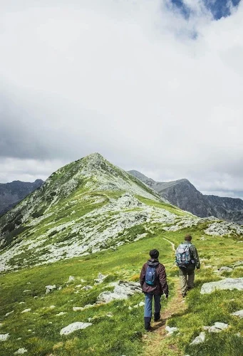
Reading a topographic map is a learnable skill that takes about an hour to pick up and will change the way you understand terrain forever. No, this is not about ditching your GPS (I use mine all of the time). It is about building a mental picture of the land before you are standing in it, so that when you get out there, nothing surprises you.
Table of Contents
What a Topo Map Actually Shows
Most people look at a map and think about trails. A topographic map shows something far more useful. It shows the shape of the earth.
Those brown lines are contour lines. Each one represents a specific elevation above sea level. Every point on a single contour line is at the exact same height. When lines are packed tightly together, the terrain is steep. When they spread apart, the ground is gentle. That is the whole system, and once you see it, you cannot unsee it.
The gap in elevation between lines is called the contour interval, and it is listed in the map legend. A contour interval of 40 feet means each line represents a 40-foot change in elevation. Knowing the interval lets you calculate how steep any section of trail actually is before you ever lace up your boots.
Learning to See Elevation
The skill that separates confident map readers from confused ones is the ability to translate 2D lines into 3D terrain.
Contour lines are numbered with their elevation. When you see a V-shape in the lines, find the numbers on the contours around it. If the numbers get higher in the direction the V is pointing, you are looking at a valley or drainage. Water flows through these. If you are planning to cross one, expect wet ground at the bottom and a climb on the other side.
Ridges are the opposite. The V points toward the lower numbers. A trail running along a ridge will show contour lines with decreasing elevation falling away on both sides. Closed circles indicate a summit or peak. A closed circle with tick marks pointing inward indicates a depression rather than a high point.
A trail that looks flat on a phone screen can tell a completely different story on a topo map. Three ridgeline crossings that look like nothing digitally might mean 1,500 feet of cumulative elevation gain. Knowing that before you go changes how much water you carry, how early you start, and how realistic your turnaround time actually is.
Aspect and What It Tells You
Aspect is the direction a slope faces, and it has real consequences for trip planning.
North-facing slopes stay cooler and hold moisture longer. In the early season, they are the last places to lose snow and the first places to stay muddy. South-facing slopes get more direct sun, dry out faster, and warm up earlier in the year. If you are planning a spring hike and want to avoid post-holing through snow, sticking to south-facing terrain can make a significant difference.
Aspect also works as a navigation check. If you know your slope faces west and you are hiking with the afternoon sun directly in your face, something is wrong. You can use the sun and your knowledge of aspects together to confirm your position without touching your phone.
Finding Water Before You Are Thirsty
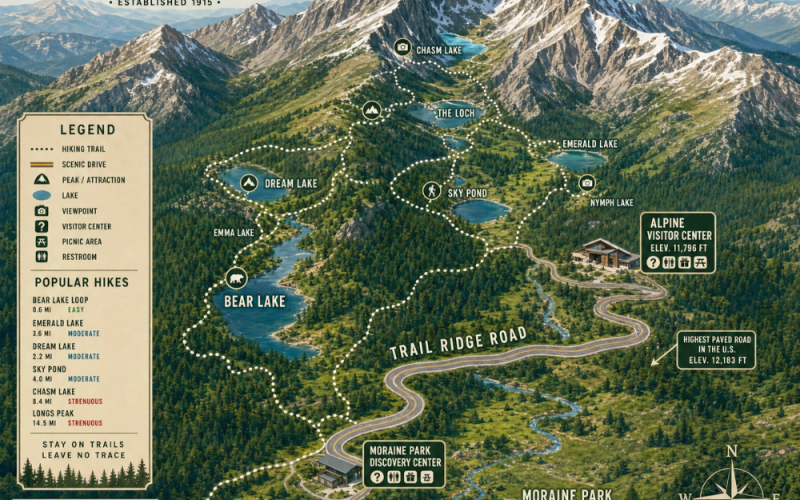
Topo maps mark water sources directly. Rivers and streams appear as solid blue lines. Intermittent streams appear as dashed or dotted blue lines on most USGS maps. Knowing the difference matters on dry summer trips when you are counting on a stream to refill your filter.
The contour lines around a water source tell you more. A stream at the bottom of a deep, tight V-shape is feeding from significant drainage above it and is more likely to be running year-round. A shallow blue line crossing nearly flat terrain may dry up completely by midsummer.
How to Practice Before You Go
Pull up a topo map of a trail you have already hiked. Try to recall what the terrain felt like and match that memory to the contour lines. Where did it get steep? Where did you cross the drainage? Find each of those moments on the map. That exercise alone will teach you more than reading about it ever will.
Before your next trip, spend ten minutes with a topo map of the area. Where does it rise? Where does it flatten? Where is the water? Ten minutes of that thinking will change how you move through terrain once you arrive.
The Map Makes Sense Now
Once you have spent any time learning to read contour lines, that situation will start to look completely different. The brown lines are no longer noisy. They are telling you the slope drops to the left and flattens to the right. They are telling you there is water ahead. They are telling you the summit is closer than it feels.
Map reading is about competence. It is about understanding the land well enough that your tools become options rather than requirements.